Loading Report
Fetching GPS data and parcel records...
Should be just a moment
Map Area Report
North Star Group, Inc.
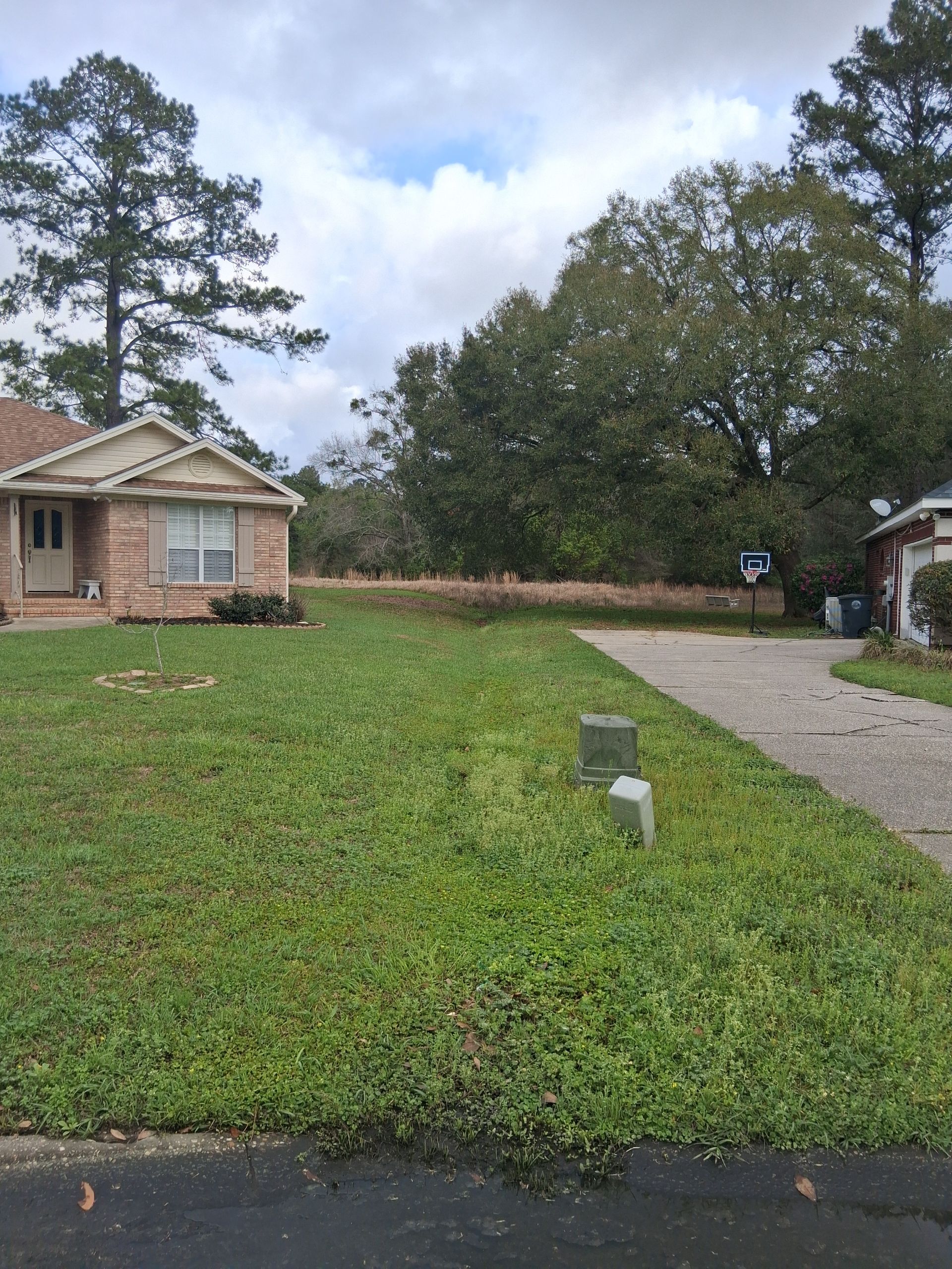
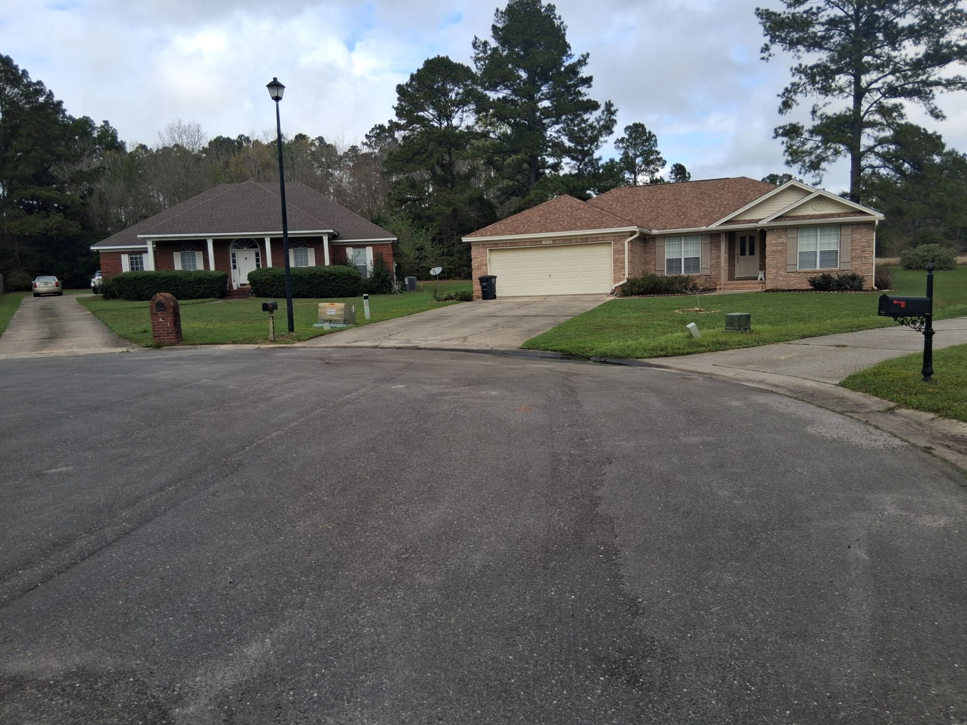
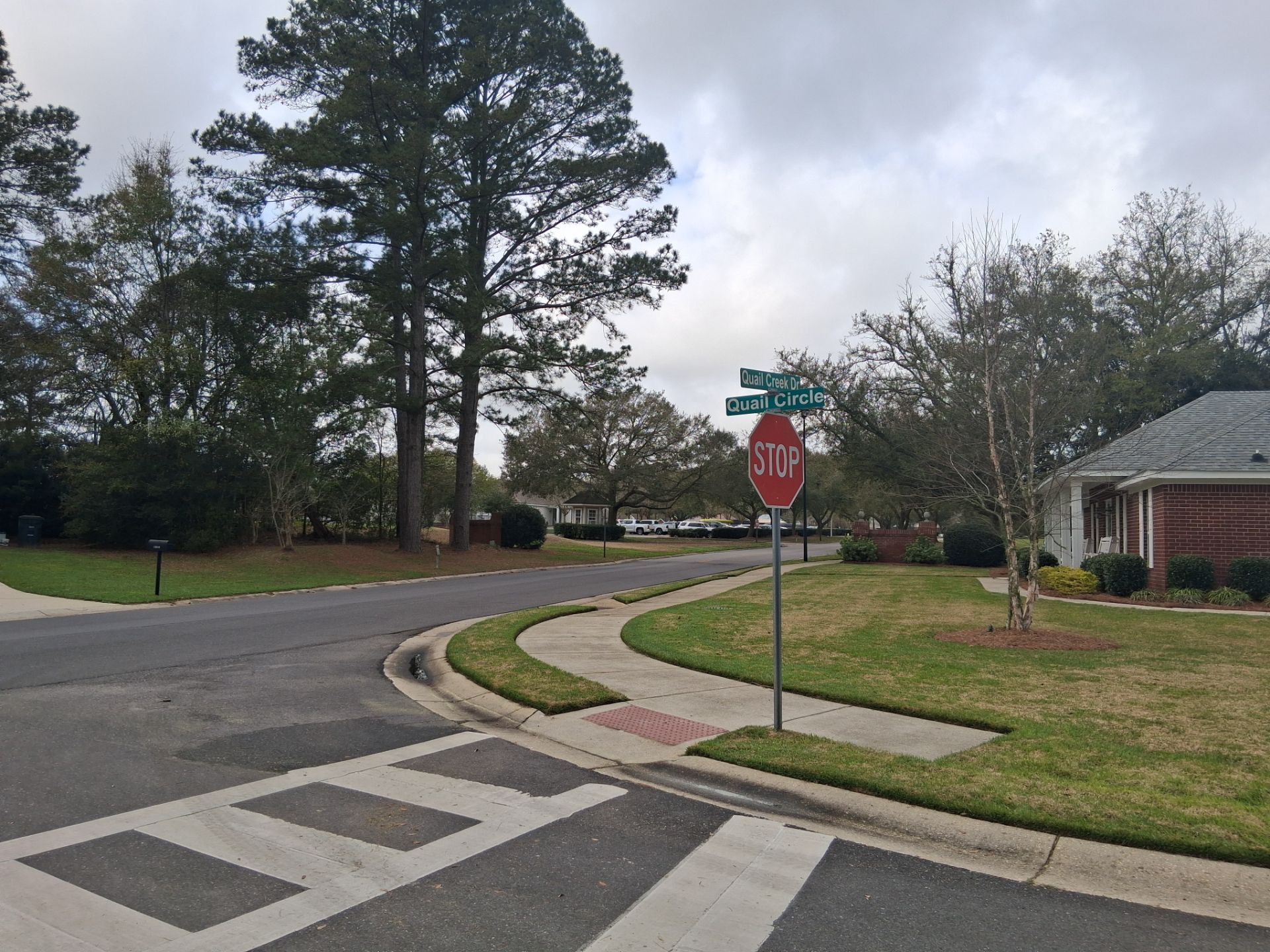
Street drain issue
Map Area Overview
| Map ID | 249 |
| Name | Street drain issue |
| Mapped Date | March 10, 2026 at 10:27 |
| Area | 458 m² (4930 ft²) |
| Dimensions | 19.5 m × 29.7 m (64.0 ft × 97.4 ft) |
| Mapper | Michael Hoffman |
| Photos | 3 captured |
| GPS Points | 76 recorded (~125 ft walking path) |
| Address | 19898 Quail Circle, Fairhope, AL |
| Personal Notes |
No personal notes added
|
| Location |
30.514456°N, -87.844917°W 📍 View on Google Maps → |
Map Area Data & Downloads
📊 Area Geometry (GeoJSON)
{"type": "Polygon", "coordinates": [[[-87.8449337500856, 30.514554538356293], [-87.84493235001712, 30.51455538767126], [-87.84493103000344, 30.51455707753425], [-87.8449307660007, 30.51455797550685], [-87.84493071320014, 30.51455863510137], [-87.84493070264004, 30.514558767020276], [-87.84493070052801, 30.514558793404056], [-87.8449259801056, 30.51455767868081], [-87.84490983602113, 30.514555295736166], [-87.84489348720423, 30.514553779147235], [-87.84487733744085, 30.514551795829448], [-87.84486554748815, 30.514548119165887], [-87.84485470949764, 30.51454170383318], [-87.84484390189952, 30.514534340766637], [-87.84483501278189, 30.5145313214388], [-87.844832922071, 30.514530611296152], [-87.84483182075601, 30.51453044765902], [-87.84482963015691, 30.514530643627026], [-87.8448256899791, 30.514530687784603], [-87.84481669214871, 30.514530697434495], [-87.84480682166459, 30.51450967158465], [-87.84480289472309, 30.514489986401404], [-87.84480185943374, 30.51447424471735], [-87.84480165191557, 30.514465970092907], [-87.8448016103831, 30.51445455401858], [-87.84480560207662, 30.514442110803717], [-87.84480896041532, 30.51443010216074], [-87.84481771208307, 30.514421620432145], [-87.84482762241662, 30.51441992408643], [-87.84482960448332, 30.514419584817283], [-87.84483000089666, 30.51442151696346], [-87.84482856017932, 30.514421903392694], [-87.84482831336044, 30.51442279191446], [-87.84482823010853, 30.514422210332484], [-87.84486424298997, 30.51442100641213], [-87.84487805018234, 30.514399132678072], [-87.84488294503953, 30.51438908212462], [-87.84488725470075, 30.51437566549139], [-87.84488997618091, 30.51437047933679], [-87.8448907064291, 30.514365515730354], [-87.84489442394586, 30.51435686998678], [-87.84490212802017, 30.51434423430331], [-87.84491264277258, 30.514331275000146], [-87.84492444855452, 30.51432193500003], [-87.8449374497109, 30.514312227000005], [-87.84494996994218, 30.514305325400002], [-87.84496191398844, 30.51430050508], [-87.84497558279769, 30.514297221016], [-87.84498511285722, 30.51429641945969], [-87.84499344600209, 30.514296130274857], [-87.84499745129855, 30.51429603632642], [-87.84500143074736, 30.514357421184588], [-87.84500320772347, 30.514374083915605], [-87.84500359990378, 30.514378876729495], [-87.84500367998076, 30.514382655345898], [-87.84500289599615, 30.51439077106918], [-87.84500169919923, 30.514396954213836], [-87.84500137983986, 30.51440171084277], [-87.84500075596797, 30.514408742168555], [-87.8449991911936, 30.51441982843371], [-87.84499887823871, 30.51443292568674], [-87.84499881564774, 30.51444554513735], [-87.84500048312954, 30.51445750902747], [-87.8450017766259, 30.514467341805492], [-87.84500403532518, 30.5144775483611], [-87.84500496706502, 30.51448726967222], [-87.845005153413, 30.514494493934446], [-87.8450051906826, 30.514504098786887], [-87.84500143813652, 30.514514659757378], [-87.8449965276273, 30.514524931951478], [-87.84499258552546, 30.514533786390295], [-87.8449849171051, 30.514542837278057], [-87.84497386342102, 30.514551287455614], [-87.84496333268422, 30.514559617491123], [-87.84496122653685, 30.514562483498224], [-87.84496080530738, 30.514563056699643], [-87.8449337500856, 30.514554538356293]]]}
📄
GeoJSON
Web mapping standard
🌍
KML
Google Earth Pro
🗺️
Shapefile
ArcGIS / QGIS
🔧
QGIS Package
QGZ with photos
📸
Photos ZIP
All 3 images
📦
Full Package
All formats + photos
💡 For Community & Technical Use:
- QGIS users: Download "QGIS Package" - includes geometry + geotagged photos
- ArcGIS users: Download "Shapefile" for geometry + "Photos ZIP" separately
- Google Earth: Download "KML" and import to see area with satellite imagery
- Web apps: Use "GeoJSON" format for most web mapping applications
Interactive Map
Walked Area
Parcel Record
🔗 External Lookups
External links open in new tabs
Site Photos (3)
Records — licenses, tags, products (2)